
The creation of the Northwest Territory in 1787 presented unprecedented territorial challenges for the young United States, requiring innovative solutions to govern and organize vast wilderness lands.
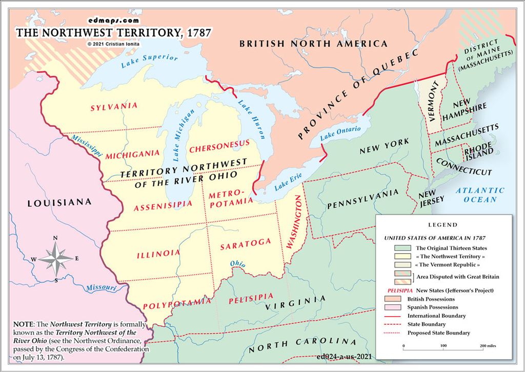
The Northwest Territory encompassed approximately 260,000 square miles, including present-day Ohio, Indiana, Illinois, Michigan, Wisconsin, and parts of Minnesota. This enormous region lacked established governmental infrastructure, defined boundaries between potential future states, or systematic land surveying. The Continental Congress faced the daunting task of creating administrative frameworks for territory larger than many European nations.
Indigenous nations, particularly the Western Confederacy led by tribes like the Miami, Shawnee, and Delaware, fiercely contested American claims. These nations had not been party to the Treaty of Paris and rejected American sovereignty over their ancestral lands. Ongoing warfare, including defeats like St. Clair's devastating loss in 1791, demonstrated that legal territorial claims meant little without military control.
The territory's vast scale created complex challenges regarding land distribution. The Land Ordinance of 1785 established the rectangular survey system, dividing territory into townships and sections, but implementing this system across such enormous distances proved difficult. Conflicting claims from Revolutionary War veterans, land speculators, and actual settlers created administrative nightmares.
The Northwest Ordinance of 1787 established a three-stage territorial government system: initial federal appointment of officials, territorial legislature when population reached 5,000 adult males, and statehood when population reached 60,000. This framework had never been tested on such a scale, requiring delicate balance between federal authority and local self-governance.
The territory's potential wealth in agriculture, fur trading, and natural resources attracted intense interest, while its strategic location controlling Great Lakes commerce and western expansion routes made effective governance essential for national security and economic development.

Lorem ipsum dolor sit amet, consectetuer adipiscing elit. Aenean commodo ligula eget dolor. Lorem ipsum dolor sit amet.

Lorem ipsum dolor sit amet, consectetuer adipiscing elit. Aenean commodo ligula eget dolor. Lorem ipsum dolor sit amet.

Lorem ipsum dolor sit amet, consectetuer adipiscing elit. Aenean commodo ligula eget dolor. Lorem ipsum dolor sit amet.