
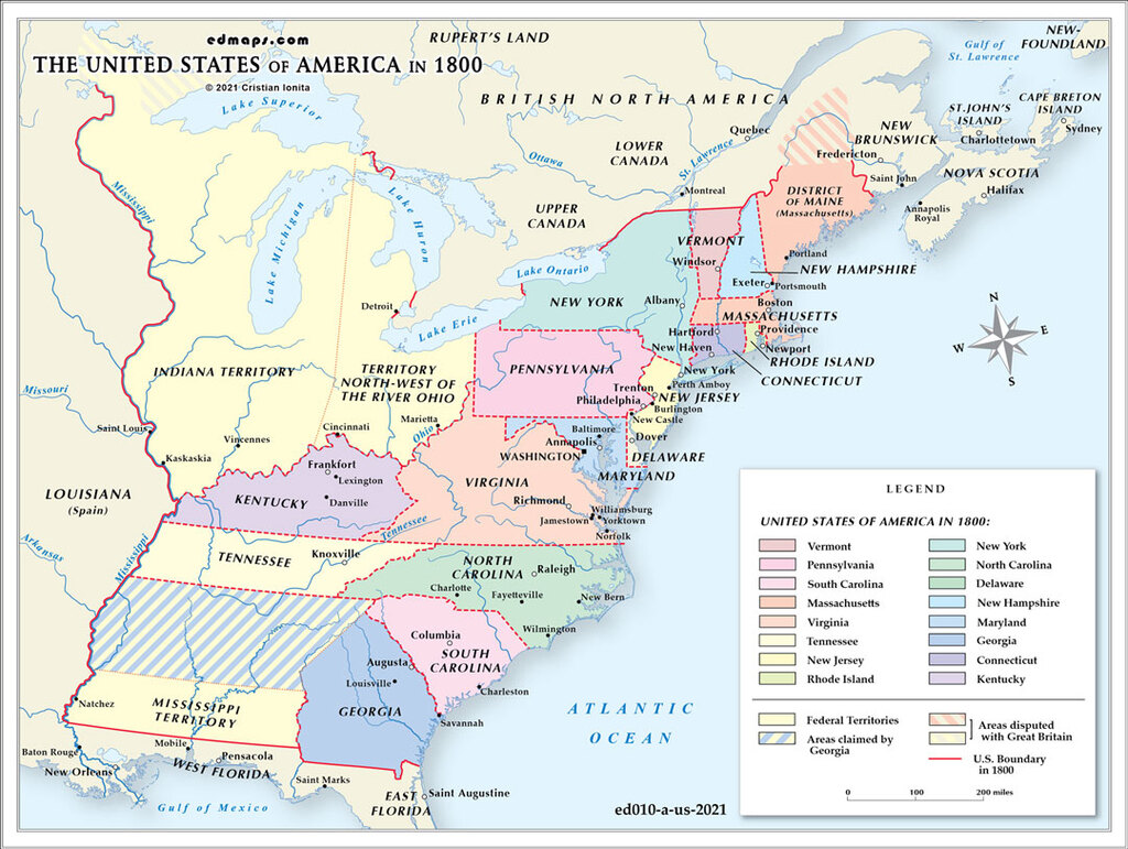
By 1800, the United States had expanded to sixteen states with several organized territories, reflecting significant territorial growth and administrative development during the 1790s.
The nation comprised sixteen states following Kentucky's admission in 1792 and Tennessee's in 1796. This expansion demonstrated the Constitution's effectiveness in managing territorial growth while maintaining sectional balance between free and slave states.
The Northwest Territory remained the largest federal territory, though Ohio was approaching statehood requirements by 1800. The Indiana Territory was carved from the Northwest Territory in 1800, with William Henry Harrison as territorial governor, encompassing present-day Indiana, Illinois, Wisconsin, and parts of Michigan and Minnesota.
The Mississippi Territory, created in 1798 from lands disputed with Spain, included present-day Mississippi and Alabama. This territory resulted from Pinckney's Treaty (1795), which resolved boundary disputes with Spain and secured American navigation rights on the Mississippi River.
The Louisiana Purchase negotiations were underway but not yet completed, leaving vast western lands under foreign control. Spain still controlled Florida and had recently retroceded Louisiana to France, creating uncertainty about western boundaries.
Under Federalist leadership, territorial administration became more systematized. The federal government exercised direct control over territorial governance through appointed governors and judges, while territories progressed toward statehood following the Northwest Ordinance model.
Several boundary disputes were resolved during the 1790s. The Treaty of San Lorenzo (1795) settled the southern boundary with Spanish Florida at the 31st parallel. However, Georgia's western land claims remained contentious, leading to the Yazoo Land controversy.
Native American nations continued controlling substantial territories, particularly in the Great Lakes region and Southeast, where tribes like the Cherokee, Creek, and Iroquois maintained semi-autonomous status despite increasing American pressure.

Lorem ipsum dolor sit amet, consectetuer adipiscing elit. Aenean commodo ligula eget dolor. Lorem ipsum dolor sit amet.

Lorem ipsum dolor sit amet, consectetuer adipiscing elit. Aenean commodo ligula eget dolor. Lorem ipsum dolor sit amet.

Lorem ipsum dolor sit amet, consectetuer adipiscing elit. Aenean commodo ligula eget dolor. Lorem ipsum dolor sit amet.